
Water
Rijkswaterstaat’s expertise in the water sector is diverse and historically significant. There are three main areas of focus: flood safety, water management (including droughts) and water quality/ecology. The Netherlands has a rich tradition in flood safety and an expertise that is the envy of the world because of its constant challenges and successes with water.
The country’s approach to water management, including drought management, is based on a deep-rooted Dutch commitment to understanding and using water in all its forms. Finally, while the country has faced water quality challenges that have raised concerns about its water systems, this adversity has stimulated innovation.
Through trial, error and subsequent correction, the nation has become adept at water quality management and ecological conservation.
From reactive to proactive: the evolution of Dutch water management
The importance of water management to Rijkswaterstaat and the Netherlands cannot be overstated. Given the country’s unique topographical challenges, ensuring flood safety is of paramount importance. With a large part of the country below sea level, the Netherlands is particularly vulnerable.
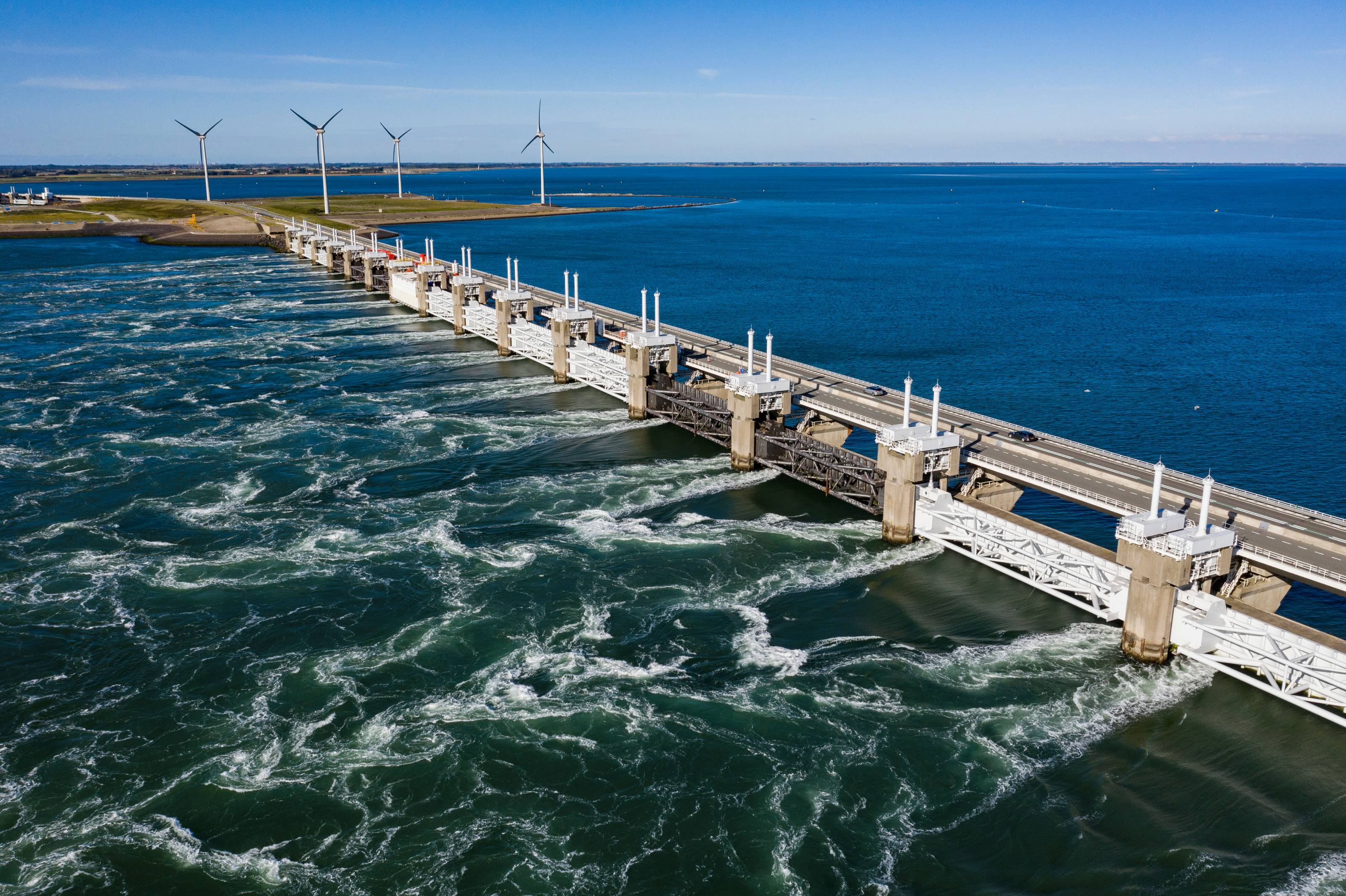
Historically, the country has responded to disasters, such as the catastrophic flood of 1953, with immediate remediation. However, the shift is now towards proactive measures to pre-empt potential future disasters. This strategic shift is embodied in initiatives such as the DELTA programme.
Equally important is the need to address water quality. Past failures in this area underline the urgent need for sustainable and effective solutions to meet national and international regulations.
Building for tomorrow: Rijkswaterstaat’s innovative water strategies
Rijkswaterstaat actively drives solutions in these areas. Through the DELTA programme, we work on flood safety and water management and play a key role as a builder and advisor. Notable projects include the reconstruction of the Afsluitdijk and the improvement of storm surge barriers to take account of rising sea levels.
What’s more, drawing on 225 years of historical experience, we have moved from reactive solutions after disasters to a more preventative approach. Using climate change scenarios from the International Panel on Climate Change (IPCC), translated by the National Meteorological Institute (KNMI), Rijkswaterstaat incorporates projections such as sea level rise into our infrastructure plans.
Such foresight ensures that structures such as the Afsluitdijk are future-proof and are built higher than is currently necessary, emphasising our commitment to long-term resilience.
Projects
Discover the international projects Rijkswaterstaat is working on within the field of water.


News
Read the latest news on water.


Want to know more?
Get in touch with Rijkswaterstaat’s team of experts - whether you’re an international professional, a member of the press or just have a question.