


Room for the River
The Dutch river basin is vulnerable. During periods of extreme or prolonged rainfall, river levels rise and the risk of flooding increases. Conversely, prolonged drought can cause water levels to fall and lead to water shortages. To prepare for these extremes, we have been giving rivers more room since the 1990s. This allows us to safely discharge more water when river levels are high and retain water more effectively during dry periods.
Weather extremes
Extreme water levels led to a new approach to flooding
The rivers distribute water across the low-lying areas of the Netherlands and discharge some of it into the North Sea and the IJsselmeer. The IJssel, Waal, Lower Rhine and Lek, all branches of the Rhine, are fed by rainwater and meltwater from the Rhine originating in the Swiss Alps. The Meuse (Maas) is a rain-fed river that flows into the Netherlands via France and Belgium.
Climate change is bringing more frequent periods of heavy rainfall and increased meltwater, causing river levels to rise and increasing the risk of flooding. At the same time, summers are seeing longer periods of drought and low water levels. This can lead to water shortages, causing agricultural land and nature areas to dry out. Rivers become less navigable, and the distribution of fresh water also comes under pressure.
Land subsidence
The problems caused by low water levels are further exacerbated by riverbed erosion. Fast-flowing water erodes the riverbed, causing rivers to become more deeply embedded in the landscape. During drought and periods of low water, this results in lower groundwater levels.
Water is also becoming less evenly distributed across the branches of the Rhine. The Waal is eroding faster than the Pannerdensch Canal, meaning that an increasing share of the water flows into the Waal and less into the IJssel and the IJsselmeer, our largest ‘rainwater tank’.
Since the floods of the 1990s, we have been giving rivers more room to keep the Netherlands safe, accessible and liveable. This approach can be clearly seen in the completed ‘Room for the River’ and ‘Meuse Works’ programmes and in the new ‘Room for the River 2.0’ programme.
Extremely high water levels: 1993 and 1995
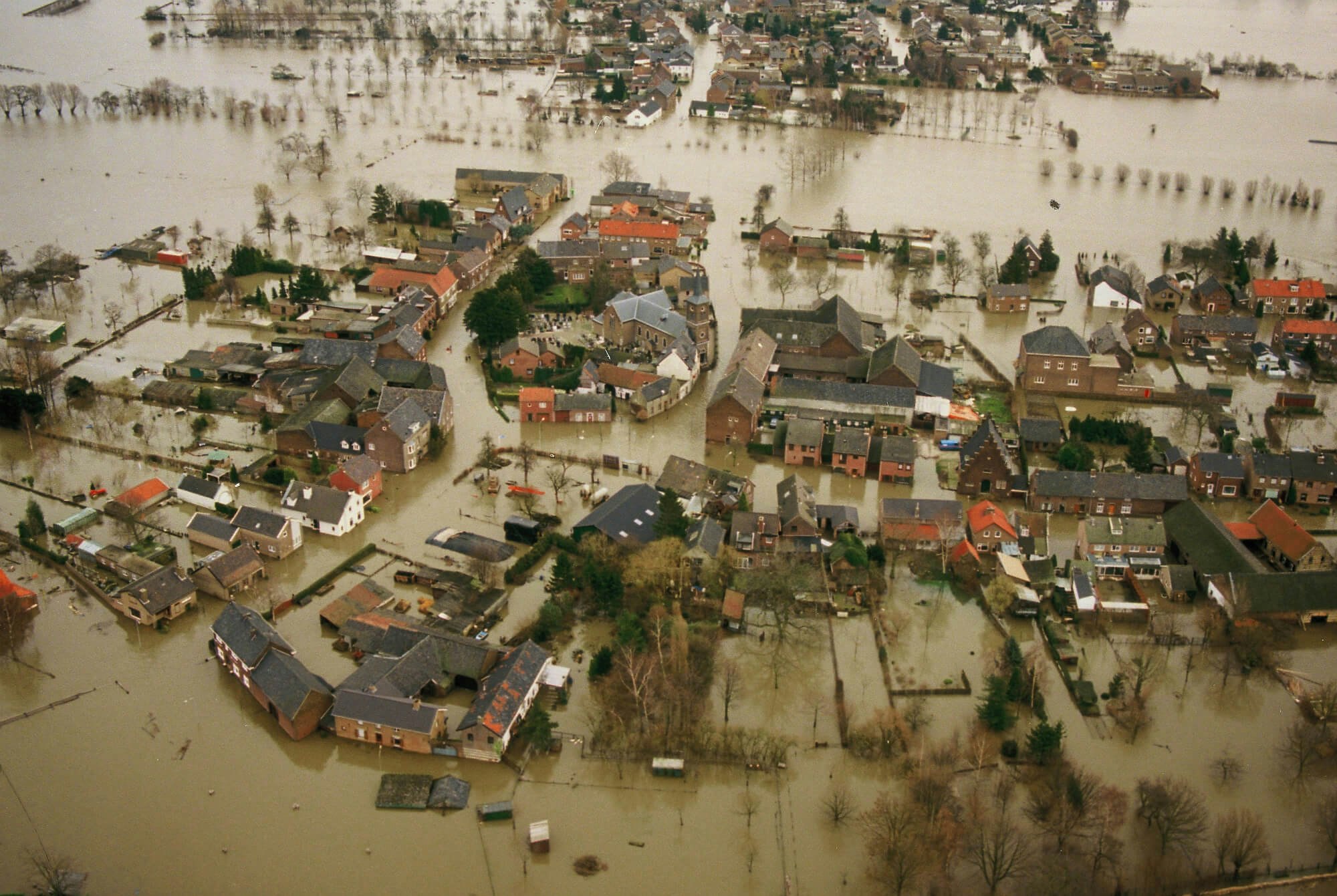
In 1993 and, in particular, 1995, large volumes of rainwater and meltwater caused extremely high water levels in Dutch rivers. In many places, the dikes were not strong enough and were at risk of failing.
In 1993, approximately 8% (18,000 ha) of the province of Limburg was under water, and unprotected villages including Borgharen and Itteren were flooded. Around 12,000 people had to be evacuated. These villages were again severely affected in 1995. In the Gelderland river basin, 250,000 people and 1 million animals were evacuated as a precaution.
Hundreds of thousands of people were evacuated as a precaution
In the years that followed, dikes in the river basin were reinforced at an accelerated pace, while new dikes were built at certain locations along the Meuse under the Delta Plan for Major Rivers. The branches of the Rhine and the Meuse also needed to be able to discharge larger volumes of water. These stricter safety standards marked the start of a new approach to high water in our rivers: giving them more room.
New approach to river flooding
Following the extremely high water levels of the 1990s, ‘room for the river’ became the guiding principle for flood protection in the Dutch river basin in 2000. We applied this principle in the completed ‘Room for the River’ and ‘Meuse Works’ programmes and continue to do so in current and new programmes. For example, the recently launched ‘Room for the River 2.0’ programme is exploring further river widening. This will enable us to store and discharge more river water and adapt to the consequences of climate change.
‘Room for the River’ Programme (2006–2019)
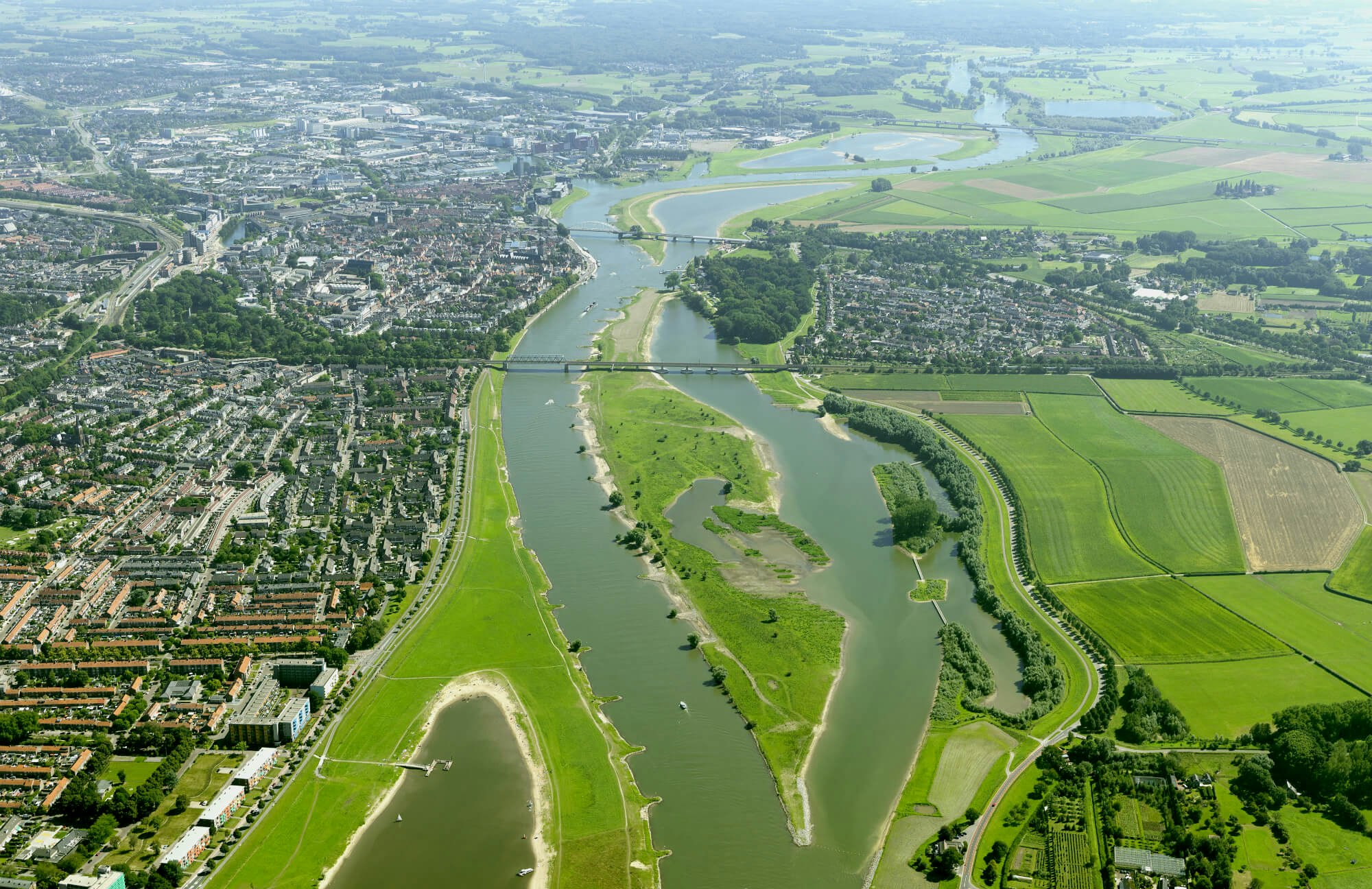
Since 2006, central government and regional authorities, working closely with local residents, have implemented measures at 34 locations along the IJssel, Waal, Lower Rhine and Lek. In doing so, we have improved safety, spatial quality and quality of life for around 4 million people in the Netherlands. The ‘Room for the River’ programme cost a total of €2.3 billion and was officially completed with the opening of the Reevediep flood channel in early 2019.
Meuse Works Programme
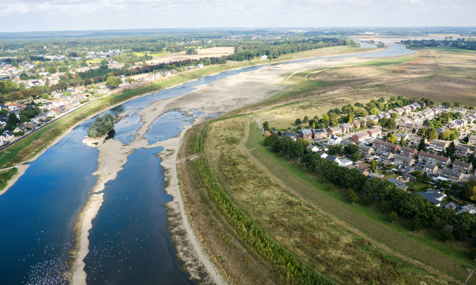
River widening under the Meuse Works Programme began in 2005. A large proportion of the costs has been and continues to be covered by sand and gravel extraction by private parties such as landowners). In 2015, we achieved the river-widening target for central and northern Limburg (Zandmaas), although work on the dikes is still ongoing. The target for the south (Grensmaas) was achieved in 2017. However, a side channel is still being constructed near Maasband, and gravel extraction in the Grensmaas will continue until 2027.
Room for the River Programme 2.0
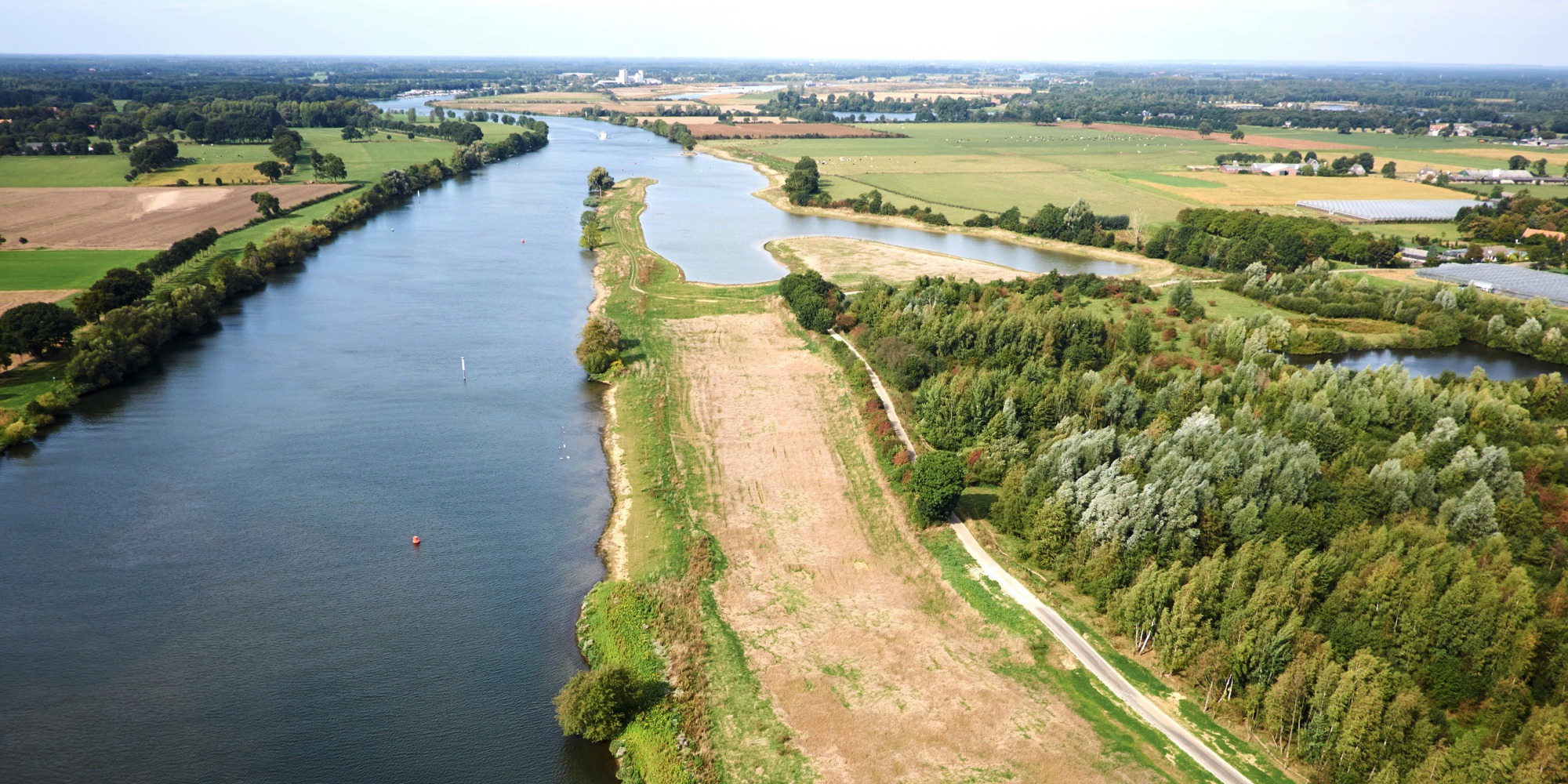
River widening is also a key focus of the ‘Room for the River 2.0’ Programme, which was launched in April 2025 as a follow-up to the Integrated River Management (IRM) programme.
Under ‘Room for the River 2.0’, central government and the regions are working on a new, future-proof layout for the river basin. As a first step, a decision will be made in 2026 on the measures needed to halt riverbed erosion, both now and in the future, and to raise the riverbed where necessary. The first steps towards implementing these measures will then be taken immediately.
The effects of erosion are already being felt, so these measures can no longer be delayed. Erosion has major consequences for agriculture, nature and the foundations of buildings, while low water levels also make navigation more difficult.
A decision will also be taken in 2026 on how much room rivers need both inside and outside the dikes. ‘Room for the River 2.0’ is examining what is needed to protect the river basin from high water and flooding up to 2100 and beyond. By reserving this space now, we can ensure that the measures needed in the future can actually be implemented. A package of river-widening measures is expected to be in place by 2029.
Measures in the river basin
Every river requires a bespoke approach. There are various ways to give rivers more room: dikes can be relocated further inland to widen the river, for example, while side channels can be dug and floodplains lowered to increase discharge capacity.
Spatial quality
Giving rivers more room also changes the layout of the river basin. As well as improving flood safety, this creates new areas for nature and recreation and an attractive living environment for people and wildlife. Sometimes, however, there is a price to pay. When areas are depoldered or dikes relocated, for example, people and businesses may have to move to make way for the river.
Collaboration on ‘Room for River’
Close collaboration with partners is essential for river widening. These include water authorities, provincial authorities, local councils, nature organisations and, along the Meuse, sand and gravel producers. After all, river widening affects a wide range of interests and is often closely linked to other spatial planning challenges.
Together with local residents, we identified locations and measures for river widening
The most important partners are the people who live in the area. In the ‘Room for the River’ and ‘Meuse Works’ programmes, for example, local residents helped identify locations and choose between different river-widening measures. There will also be opportunities for public participation in the ongoing ‘Room for the River 2.0’ programme. Only by working together can we make the river basin safer from flooding while also strengthening its economy, ecology and landscape.

Take a look for yourself
You can also visit places where we have given rivers more room and see for yourself how these measures improve the area, both during high water and under normal conditions.
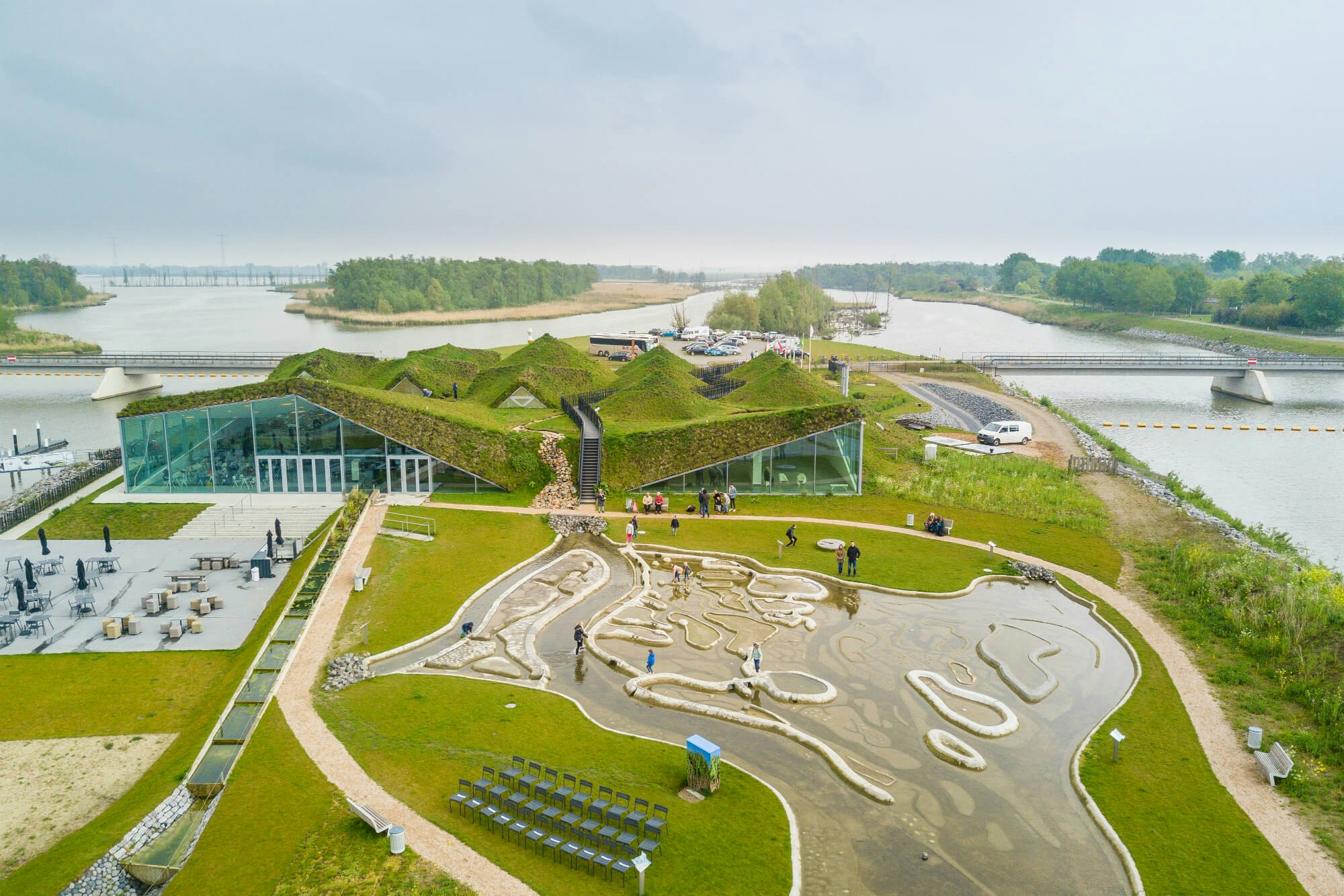
Biesbosch MuseumEiland
A good example of river widening can be seen in and around Biesbosch MuseumEiland. Here, we began depoldering the Noordwaard in 2009. Over a period of five years, we reorganised an area of 4,450 ha (around 6,000 football pitches). We partially lowered the dikes, allowing large volumes of river water to be discharged.
On your way to the museum, you can see what it means to give land back to the water. All the houses and farms, for example, stand on mounds (artificial hills) to keep them dry during high water. At the museum, you can watch a film about the creation of the new Noordwaard.
Protection against high water is never complete
The climate is constantly changing, and the Netherlands remains vulnerable to flooding. This means we must remain vigilant and take timely action so that we can continue to live, work and enjoy our leisure time safely in the Netherlands. Protection against high water is never complete.