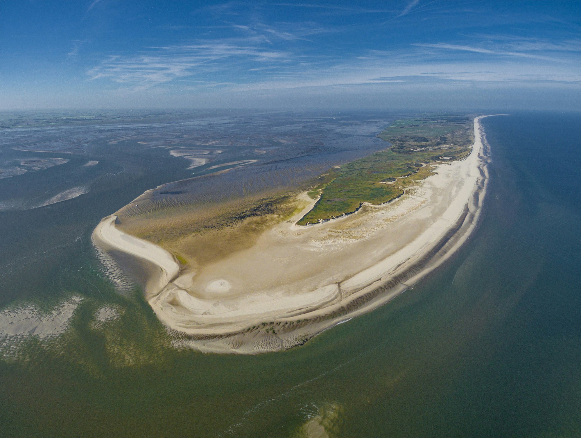
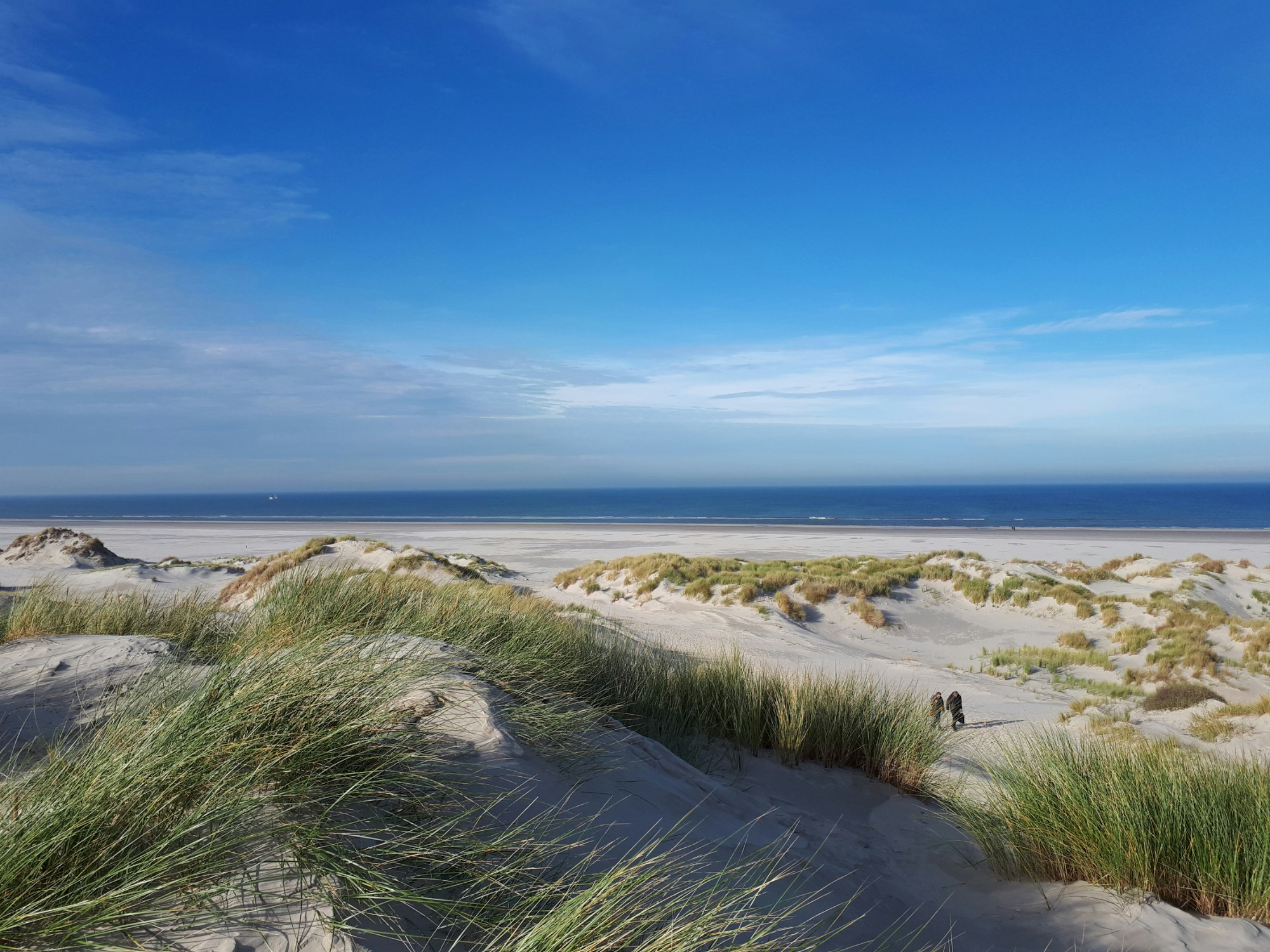
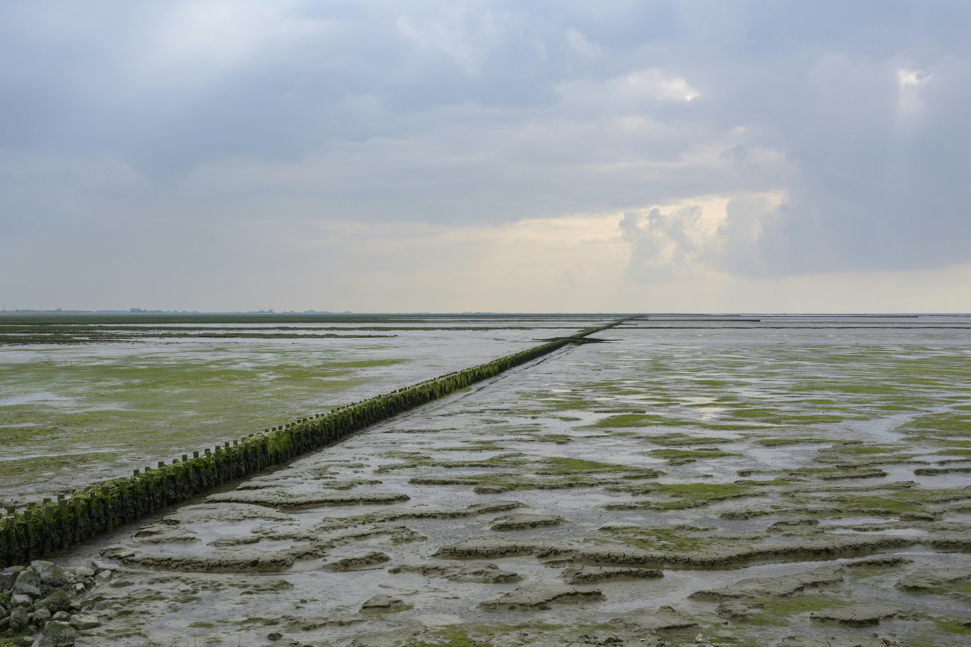
Spatial planning in the Wadden Sea region: natural dynamics as a starting point
Preserving the unique qualities of the Wadden Sea region requires a coherent and broadly supported vision for spatial planning. Such a vision must bring together and balance a range of interests, including ecology, the economy and water safety. The Wadden Sea region is a prime example of how integrated water and land management can work in a dynamic coastal environment.
This approach is closely aligned with European frameworks such as the Water Framework Directive (WFD) and Natura 2000, and depends on intensive cross-border cooperation between the Netherlands, Germany and Denmark. Within this complex landscape, Rijkswaterstaat plays a key role as both a manager and implementing agency, contributing expertise in ecosystem restoration and ecological measures.
How does this work in practice? We spoke with Matthijs Buurman (Province of Groningen), Rick Timmerman (Rijkswaterstaat) and Xandrie Borgmans (National Delta Programme, Wadden Area).
The discussion participants
- Matthijs Buurman, coastal development programme manager, Province of Groningen
- Rick Timmerman, network development and strategy adviser, Rijkswaterstaat Northern Netherlands
- Xandrie Borgmans, programme manager, National Delta Programme, Wadden Area
How are you involved in spatial planning for the Wadden Sea region?
Matthijs Buurman: ‘On behalf of the Province of Groningen, I’m responsible for coastal development projects. We always try to combine multiple functions, such as flood protection, ecology and agriculture. We started doing this in the Eems-Dollard region in 2014 - 2015. Since then, we have continued to build on that approach, constantly looking for ways to combine different interests and functions.’
Rick Timmerman: ‘Rijkswaterstaat is involved in spatial planning in the Wadden Sea region in a variety of ways. We manage the Wadden Sea both as a Natura 2000 site and as a waterway. In addition, as the implementing agency of the Ministry of Infrastructure and Water Management, we contribute to the Agenda for the Wadden Sea Region 2050 and its implementation programme.’
Xandrie Borgmans: ‘The National Delta Programme for the Wadden Area focuses on maintaining flood defences within a natural and resilient Wadden Sea region, with a long-term perspective. We’re involved indirectly in spatial planning issues, such as the space needed for flood defences and how those defences should be designed. We also contribute to the implementation programme for the Agenda for the Wadden Sea Region 2050, for example through work on coastal development.’
What makes the Wadden Sea region unique?
Buurman: ‘Its dynamics. The Wadden Sea is a truly remarkable natural system. Formally, those dynamics stop at the dyke, but in reality they don't. That creates challenges in areas such as agriculture and nature management.’
‘Take Lauwersmeer, for example. The farmers around the lake need fresh water, and so does nature. In that sense, their interests overlap. Natural transitions between fresh and salt water are essential to the Wadden Sea region. That is precisely what makes the area so unique – and what makes my work so interesting.’
Borgmans: ‘You've put that very well, Matthijs. For me, too, the beauty of the Wadden Sea region lies in its natural dynamics. The interaction between wind, water and land is what makes the area unique.’
Timmerman: ‘One of the things that makes the Wadden Sea region so special is the Wadden Sea itself. It's as if it's constantly reminding us: “I’m dynamic and I do my own thing.” I agree with Matthijs and Xandrie that those natural dynamics should be our starting point for spatial planning. That means looking, for example, at freshwater-saltwater transitions and adopting a more adaptive and innovative approach to issues such as maintaining ferry routes.’
‘I think most parties in the Wadden region broadly agree on the direction we need to take. The challenge lies in turning that shared ambition into concrete action.’
What is your vision for the Wadden Areas in 2050?
Timmerman: ‘By 2050, the Wadden Sea region should be both climate-resilient and ecologically resilient, working with its natural dynamics rather than against them.’
Buurman: ‘I agree. My ideal vision is one in which the region's natural dynamics have been restored. That is what we are working towards through the Agenda for the Wadden Sea Region 2050, and the relevant sectoral programmes are already underway. At the same time, we know that the process is complex. Different parties naturally bring different interests to the table.’
‘Even so, I am convinced it can be done. In the Eems-Dollard region, for example, we have successfully created more room for natural processes. At Lauwersmeer, agricultural and nature organisations came together to discuss the area's future. Together, they developed a shared long-term vision that other stakeholders, including policymakers, were able to support.’
Borgmans: ‘I agree. Particularly in light of climate change, we need to make much better use of the natural systems that already exist in the Wadden Sea region. We need to stop trying to reshape the area to fit our wishes.’
What principles should guide spatial planning decisions in the Wadden Sea region?
Borgmans: ‘All spatial planning decisions should start from the area's natural dynamics. Activities that undermine those dynamics should gradually be phased out.’
Buurman: ‘I agree. Spatial development should be aligned with the way the Wadden Sea system functions.’
Timmerman: ‘That also means starting from the challenges we face: understanding how the system works, recognising its dynamics and making decisions accordingly. That’s not always easy. The Lauwersmeer example Matthijs mentioned gives me hope in that respect.’
What role can an Environmental Impact Assessment (EIA) play in shaping this vision?
Buurman: ‘An EIA can be a very effective way of putting these ideas into practice. By mapping the effects of spatial plans, it helps make the benefits and trade-offs for nature, the economy, water safety and other interests visible.’
Timmerman: ‘It's an important instrument in the spatial planning toolbox. We are currently carrying out an EIA as part of a Natura 2000 management plan. It's a challenging process, but it also generates valuable insights.’
Borgmans: ‘Exactly. An EIA allows you to assess the environmental effects of your spatial plans at an early stage. It’s a flexible instrument: depending on the issue, you can choose a broad or a more focused approach.’
Buurman: ‘One thing I do see in practice is that collaboration could be improved. We could combine EIA processes much more effectively. In our region, for example, an EIA is currently being prepared for a Natura 2000 management plan, a cable connection near Schiermonnikoog, and a dyke reinforcement project. These projects are located close to one another. Surely there must be opportunities to coordinate them better.’
Borgmans: ‘That’s definitely a challenge. Capacity is part of the issue. People may be willing to collaborate, but there’s so much happening at the same time that combining processes can be difficult. An integrated approach is not always simpler, nor does it necessarily reduce the workload.’
Buurman: ‘I recognise that. In our region, many of these projects end up involving the same people.’
Timmerman: ‘Perhaps that's a good note to end on: let's keep looking for ways to work together more closely.’